Day 112: Oregon High Point
Date: Tues 8/7
PCT Start Mile: 1839.2
PCT End Mile: 1869.6
PCT Mileage for Day: 30.4
Alternate Trail Mileage: .5*
Total PCT Mileage: 1869.6
The Highlights: OR/WA high point

*Camped on the alternate Rim Trail last night, about half a mile from the junction with the official PCT.
Today’s blog will be much shorter than yesterday’s. Mostly because there just wasn’t as much excitement as our Crater Lake day 🙄, and also… I’m tired 🙂

Today was fairly ho-hum, nothing super duper exciting… but a good day all the same. Mornings in Oregon have been chilly and today was no exception, I pulled on my rain pants and jacket to keep warm for the first few hours of the hike, which were super flat and easy. A great way to start the day.
Every once in awhile we’d walk through an area that was all the sudden much colder. It reminded me of times I’d be swimming in a lake or the ocean and all the sudden swim through a spot that was much colder or warmer than the surrounding water and get a little freaked out. Why is it so warm/cold right there!? What’s under me?! But, I digress…

As mentioned, our morning hike was mostly flat. By mid-morning and through early afternoon, the trail climbed gradually, eventually rolling into undulating terrain for the rest of the day.

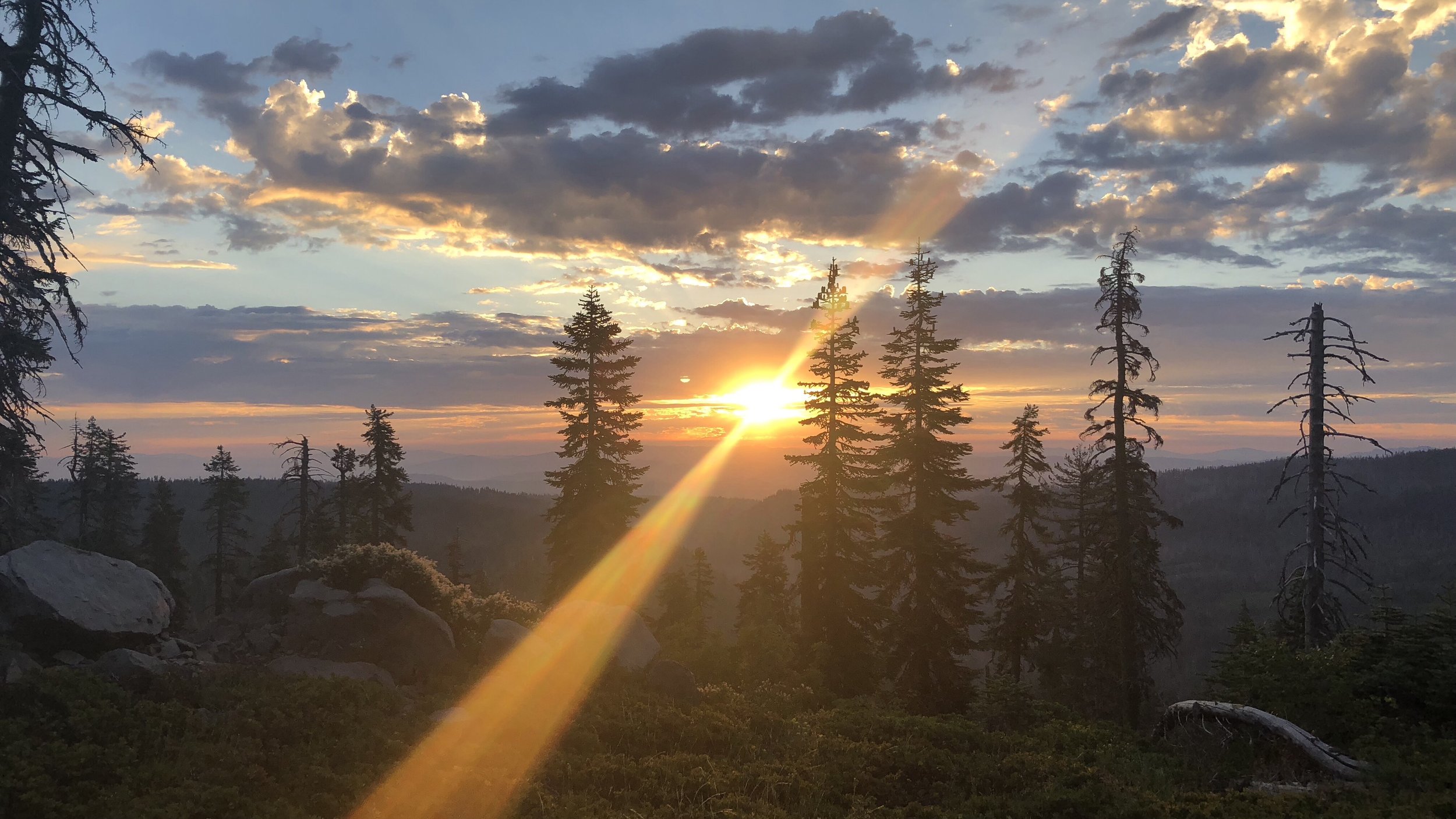
About four and a half miles after our lunch break, we topped out on our longest climb for the day, which peaked at the PCT high point for Oregon (and Washington, according to the sign), at 7,560 ft. The high point for the entire PCT was Forester Pass in the Sierras, which was 13,153 ft, and we were above 7-8,000 ft many times in our traverse of California. So… this was kinda small fries.

That was about the most excitement we had for the day. Some good views. A little over 30 miles for the day, and we passed the 3000 km mark, for anyone thinking in kilometers, which seems more rewarding since the numbers are higher and the kilometers pass by faster. 😆

Along with the normal cast of north-bounders (NoBos) we’ve been leapfrogging with, we’ve also begun crossing paths with a lot of south-bounders (SoBos) on the trail since we entered Oregon.
SoBos, as you can guess, start at the Canada border and hike to Mexico. Hiking southward, you get started later (usually in June or early July) after the bulk of the snow in the Cascades in Washington has melted, which was a little later this year. They typically finish in Mexico sometime between October to late November or early December. I can tell you that when we pass them, I am happy to be closer to the end of our journey than the beginning!
Tonight there are a lot of very loud bugs making their nighttime noises. Pipe down out there! It’s time for sleep!