Day 1 – South Rim to Cottonwood Campground
Start: South Kaibab Trailhead
End: Cottonwood Campground
Total Distance: 14.3 mi
Total Elevation Gain: ~2200 ft

Despite being excited about this hike, I was not very excited when my alarm went off. “Noooo!” I whined out loud. I had not slept well. I hit snooze and dozed for a couple more minutes before sitting up in bed, easing myself into my day the way anyone does: checking their phone.
Skipping past the news, I checked the weather for both the north and south rims of the canyon, as well as Phantom Ranch, which sits near the lowest point of our hike. The current weather along the south rim was 50°F and windy. The high at Phantom Ranch for the day would climb to over 80°F in the early afternoon.
I took screen shots of the weather reports for the next three days. There would be no cell service in the canyon.
Overall, the weather was looking very good for our hike. Today was the last day in the foreseeable forecast that Phantom Ranch would see such high temperatures. The rest of the week showed highs there moving into the 60s and 50s. Though summer temperatures have lasted longer than usual this season, winter is coming.
After washing up, I made one last cup of coffee. We never pack out coffee for backpacking trips. Typically we prefer to just get going in the morning rather than sitting around for a cup of joe. This makes coffee taste that much better when we return to civilization.
Packing up the last of our things, we checked out of the hotel and made the short drive back to the Visitor Center.
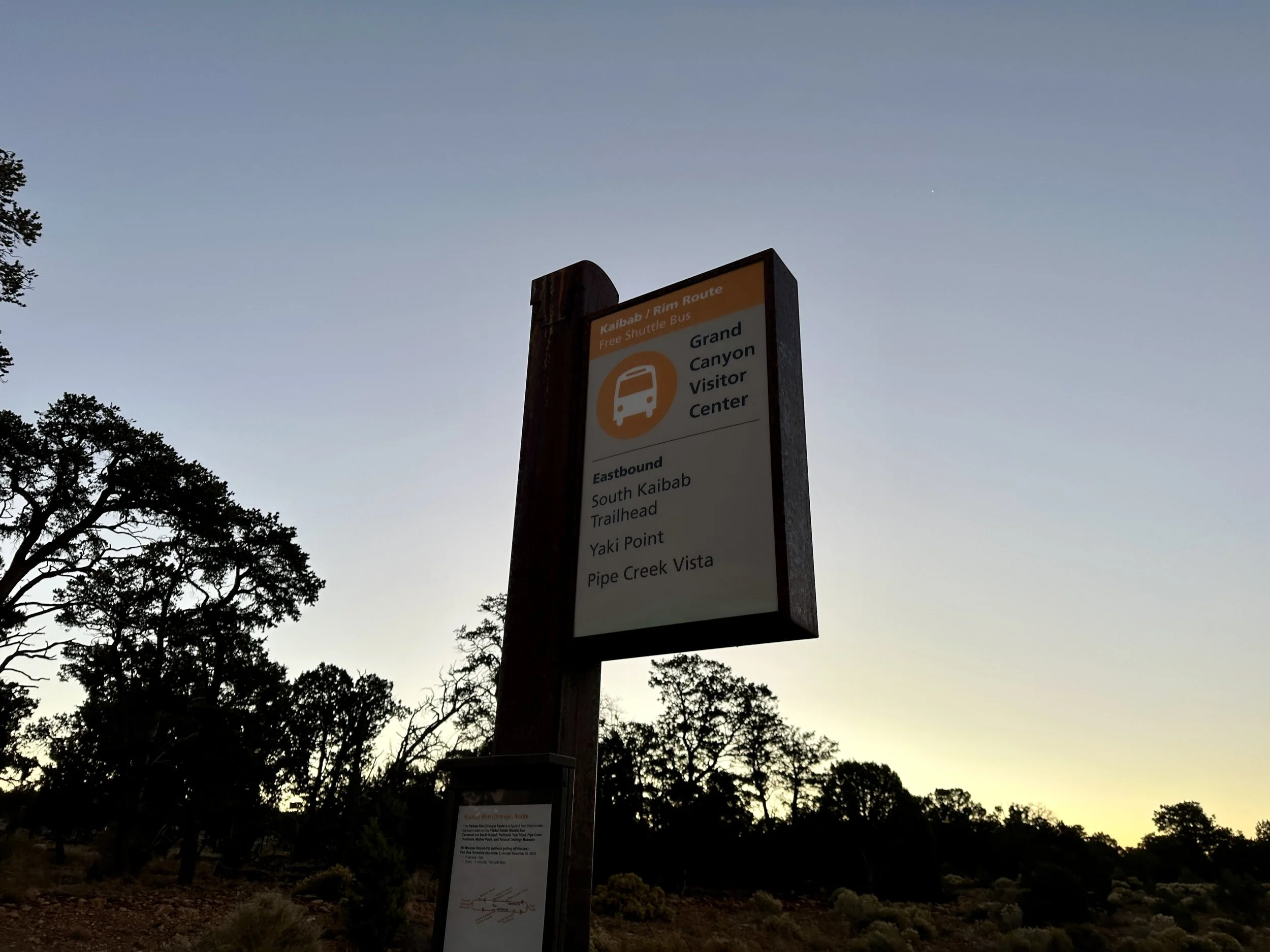
Orange route to the South Kaibab Trailhead.
The morning was cold and blustery. I pulled on a thin wind jacket and rain pants over my sun shirt and shorts for a bit of extra warmth as we waited for the shuttle to the South Kaibab Trailhead, where we would begin the hike.
About ten to fifteen others joined the shuttle cue as it approached 7am, the most boisterous of this morning crew asking everyone what hikes they were doing today.
Several others were doing the ‘Cowboy Loop’, which is about 14 miles taking the South Kaibab trail down to the Colorado River and then returning to the south rim via the Bright Angel trail. We assume this is called the cowboy loop because it is the same route that the mule train takes with supplies in/out of Phantom Ranch.
Others, including the original inquirer, were doing shorter hikes down the South Kaibab trail to Ooh Aah Point, Skeleton Point, or other lookouts.
The shuttle arrived promptly at 7am and the driver announced the next stop as South Kaibab Trailhead. At this point, I had heard ‘Kaibab’ pronounced at least four different ways, even several variations by park rangers and staff. KI-bab. Key-BAB. KI-bob. Kah-bab. And others. I still do not know the correct pronunciation.
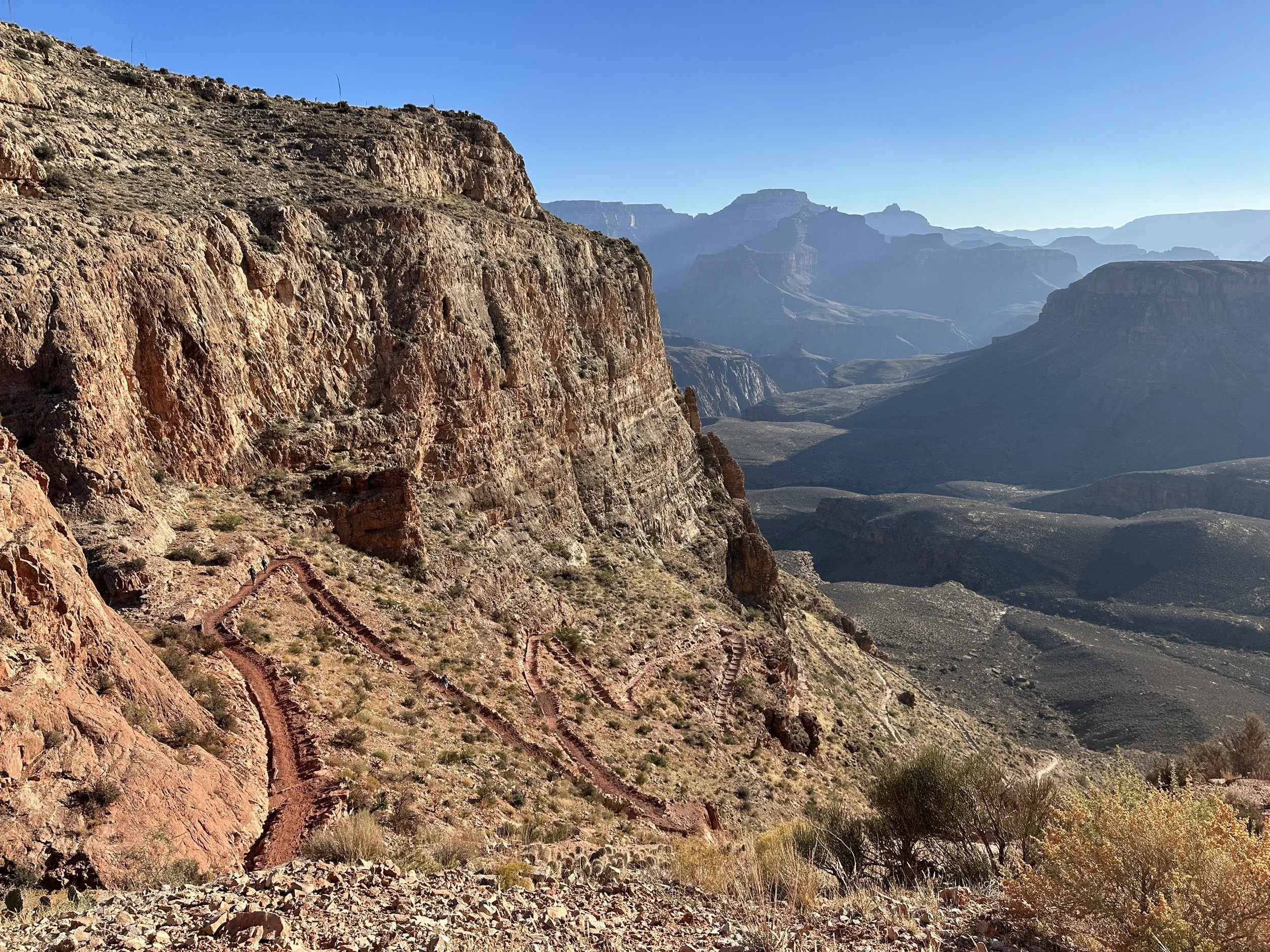
Less than 20 minutes later, we stood at the top of this South Kai/Key/Kah-Bab/Bob trail. Wind in our faces.
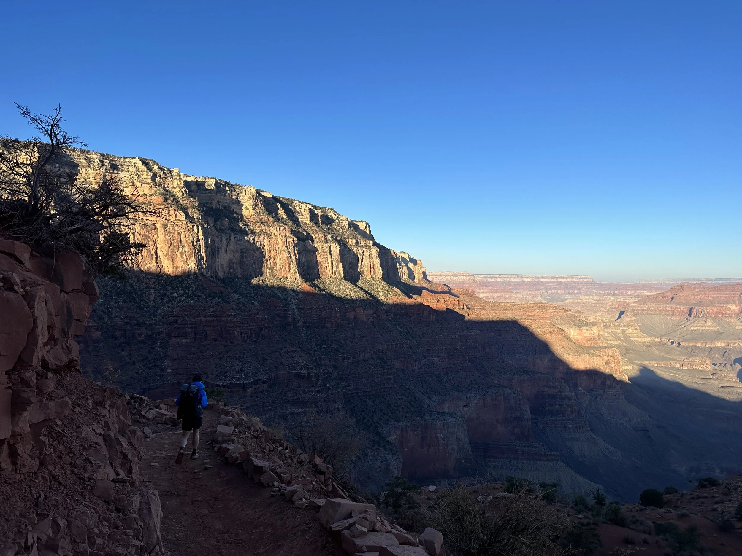
Sun filters over the south rim of the Grand Canyon as we make the seven mile descent to the Colorado River.
Starting down, the morning sunrise lit the upper reaches of the north rim of the canyon in a pale pink, much as sunset had last night. As the trail switchbacked along the canyon wall, a warm yellow glow began to illuminate the highest edges of the southern rim, as well.
While the morning was a bit blustery, for the most part weaving along the canyons walls shielded us from much of the wind. Other than a couple of stretches…
As we approached Ooh Ahh Point, the furthest we had hiked down this trail on our last visit, strong wind gusts ripped past the point. The mule train, who we had stopped for not long ago, now stopped once again to resituate their ropes in the strong winds. I would not want to be on a horse in these wind gusts.
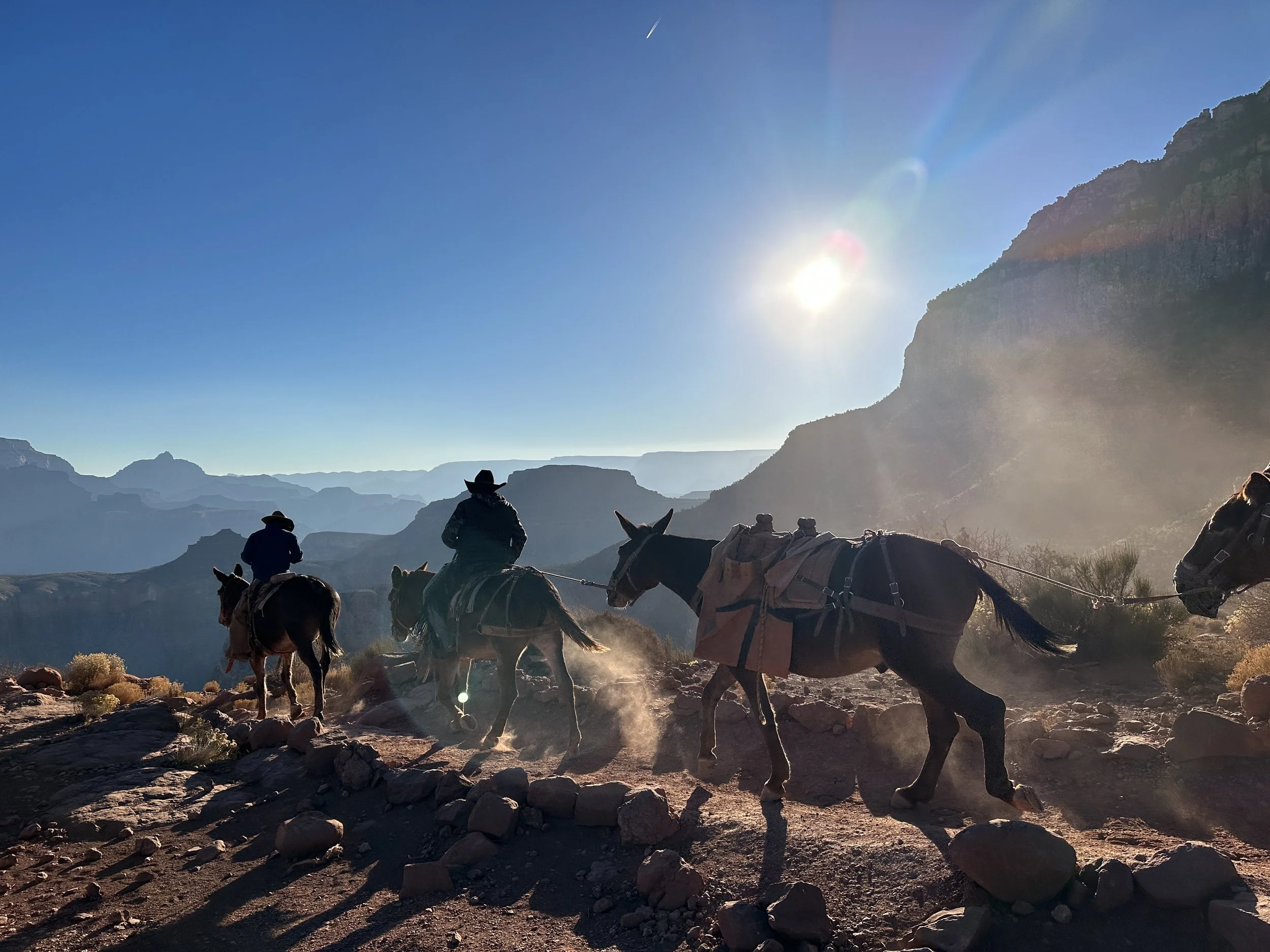
A mule train makes a daily supply run to Phantom Ranch.
We stayed ourselves against the strong gusts as we rounded the point, the wind calming again as we hugged the canyon walls.
Just down the trail in another blustery gust, Shawn’s sunglasses went on a suicide mission, blowing off his hat and down the slope of the canyon. We looked for them as best as we could from a couple spots where the the slope was accessible from the trail, but no luck. Unfortunately this means Shawn will go the next several days without sunglasses. And, we have littered the canyon. I wonder how many hats and sunglasses the desert scrub of the canyon is holding.
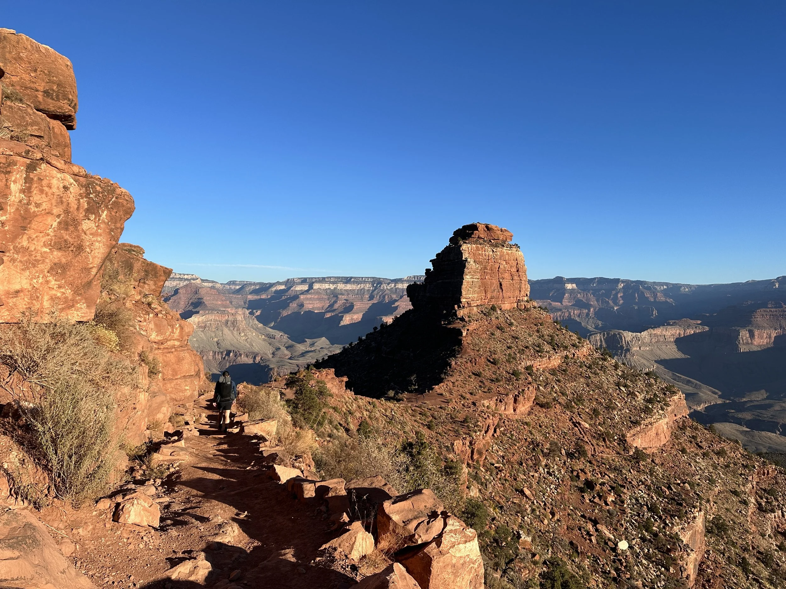
Descent along South Kaibab Trial.
Continuing down the trail, the morning continued to warm and soon we’d stripped off any extra layers we’d started with for the morning. As the trail weaved down the canyon, it hugged canyon walls, switchbacked around side canyons, and gently curved by stunning rock formations, carved by wind and water erosion through time. Some of the towering rock formations are referred to as ‘temples’, a moniker that’s easy to understand as you hike by, dwarfed by the craggy canyon walls, jagged rock outcrops, and soaring pinnacles.
Switchbacking our way through the canyon.
The colors of the canyon, too, formed a layer cake of reds, whites, yellows, oranges, grays, and the greens of scrubby plants and small trees clinging to the canyon sides. The dirt beneath our feet would go from burnt yellows to rich irony reds and rocky grays. There was always something to look at.
View of the Colorado River from South Kaibab Trail.
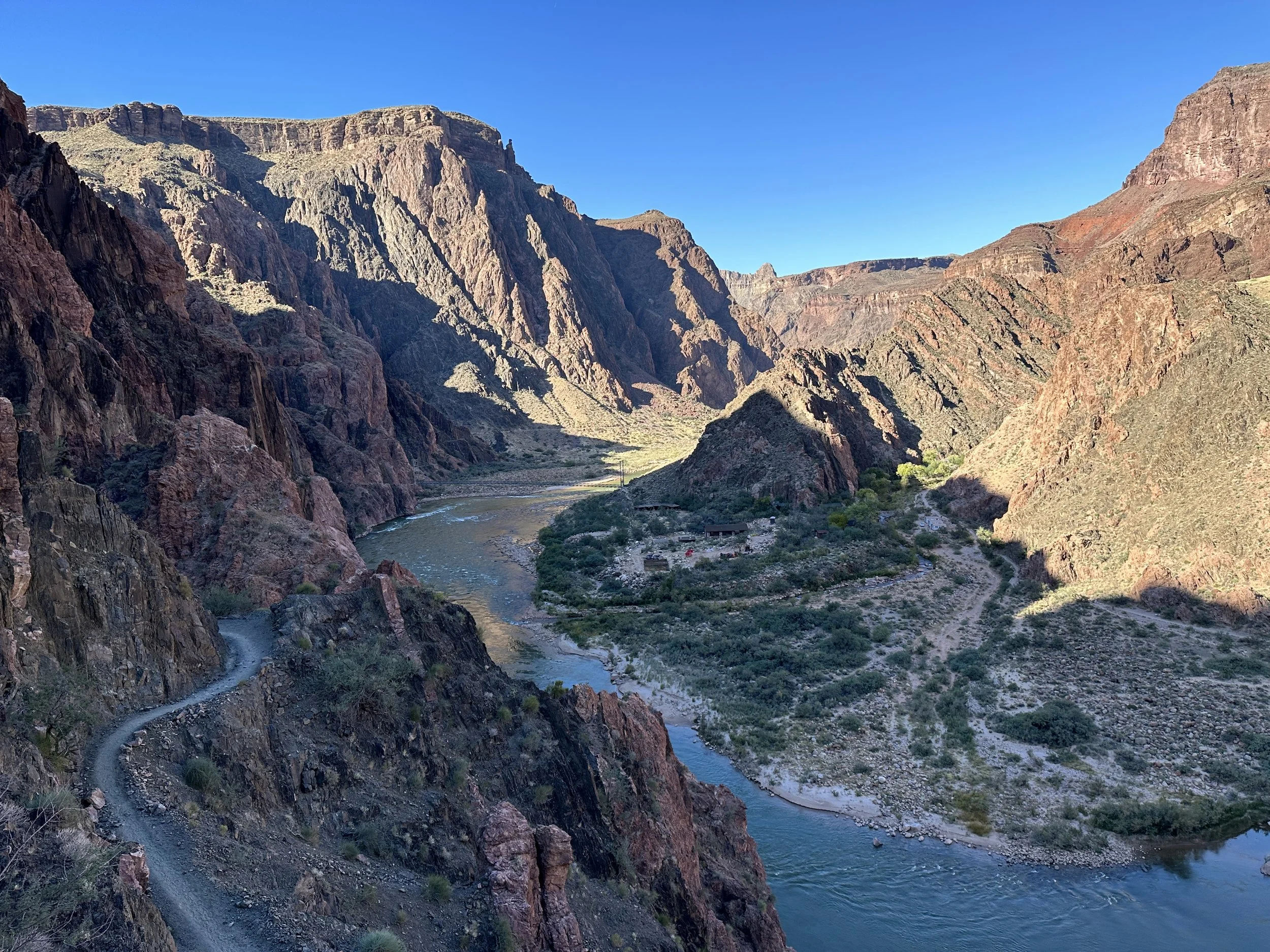
The trail bottomed out at the Colorado River, where a small tunnel led to a bridge over the river. When constructed in 1928, the 440 ft long bridge was the only crossing of the Colorado River for a 754 mile stretch from Moab, Utah to Needles, CA. All components had to be brought down the seven mile trail by man and mule, including 550 ft long, 2300 lb suspension cables. Today the bridge is designated a National Historic Civil Engineering Landmark.
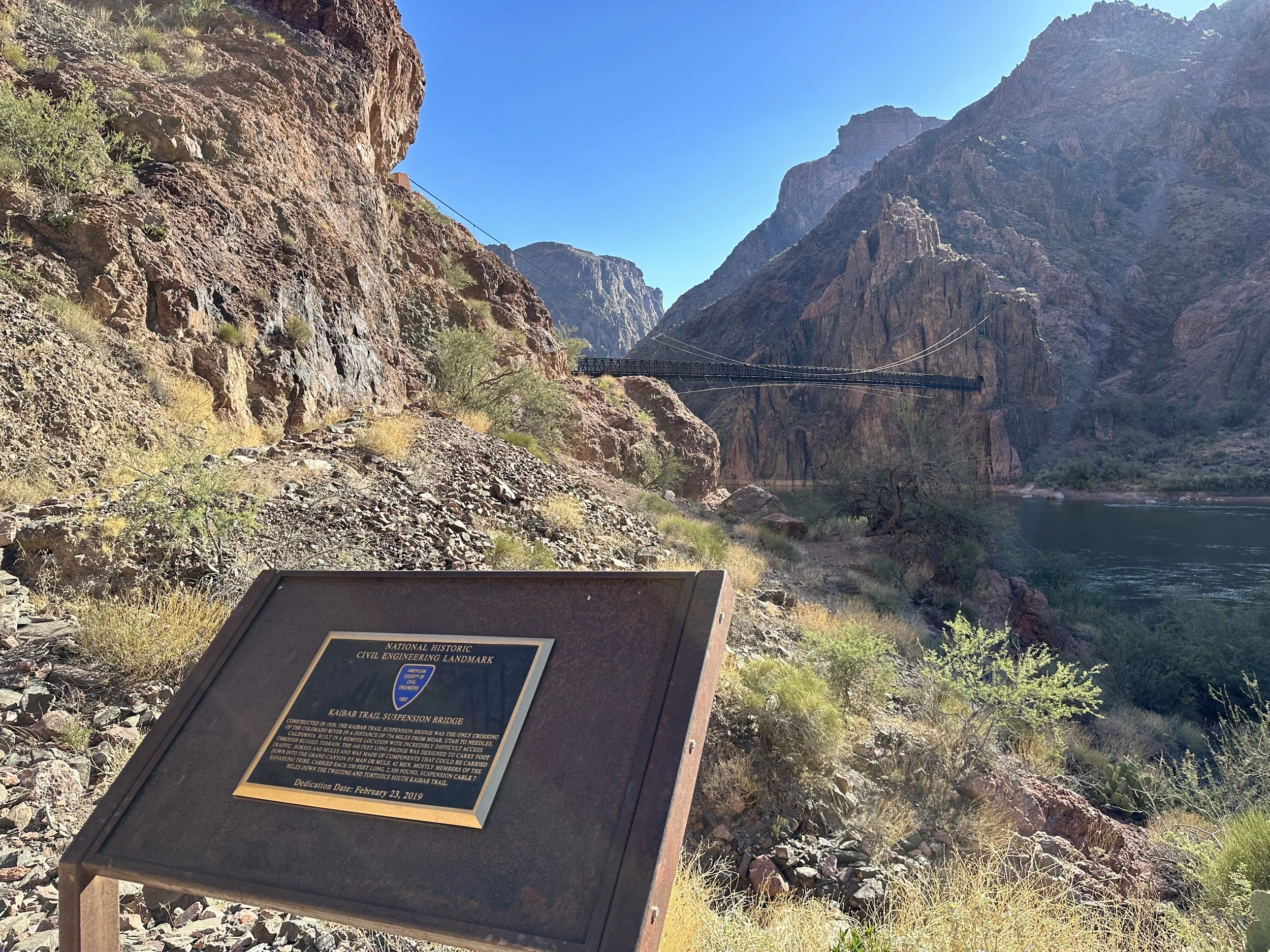
The bridge over the Colorado River from the South Kaibab trailhead is designated a National Historic Civil Engineering Landmark.
We took our time walking across the bridge, the silty green Colorado River flowing below. Across the canyon, the trail hugged the river for a bit before diverging to the north at the confluence with Bright Angel Creek, which the trail would follow the remainder of the day.
While the trip down from the south rim had felt fairly barren other than short plateau areas with desert grasses and bushes, now that we were along the river, the riparian corridor exploded with green. Several types of cactus and trees lined the trail and tiny lizards darted across the sand. It reminded me of the desert section of the PCT.
Lizard country.
Another half mile or so down the trail, we arrived at Phantom Ranch, a small settlement of cabins, dorms, a dining lodge (for those staying), and a canteen. Phantom Ranch is a coveted stay along the trail, a lottery for reservations opening over a year in advance. It is very difficult to get reservations. We did not have a reservation.
But, we could still visit the canteen! We had heard that the lemonade was a must and, since the day was heating up quite nicely, an ice cold lemonade would be just the ticket.
We wound our way through the buildings to the canteen, where a few other hikers were scattered at picnic tables, enjoying lemonades or mid-morning snacks. We quickly had lemonades in hand as well.
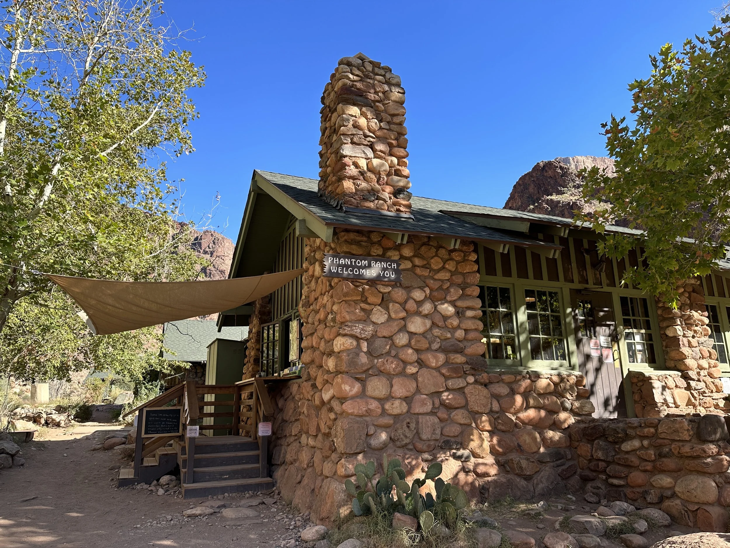
Phantom Ranch Canteen.
And, while it was only around 10:30am, since we knew we’d be eating an early camp dinner before the 5:30pm sunset, we decided to eat an early lunch as well. It’s always nice to have a picnic table available for a meal. We fired up our camp stoves and soon enough we were tucking into chili ramen. (The best ramen flavor, btw. No arguments).
While we ate, we talked with Shane, another hiker who we had met briefly at the beginning of the trail this morning. He was doing the hike from the south rim to the north rim today, where his wife would pick him up. The two of them lived on the road, traveling around in their van. While he had rafted through the Grand Canyon twice, this was his first hike through and his first time stopping at Phantom Ranch. He told us all about the rafting trip and how the permitting system worked. Basically, a lottery system and a lot of very early planning.
With another 14 miles to go before sunset, he set off a bit before we hit the trail again, but we weren’t long after. Finishing up our lemonade refills, we hit the trail around 11:30am. Having hiked 7 miles to Phantom Ranch, we were halfway through the hike to Cottonwood Campground, where we would spend the night.
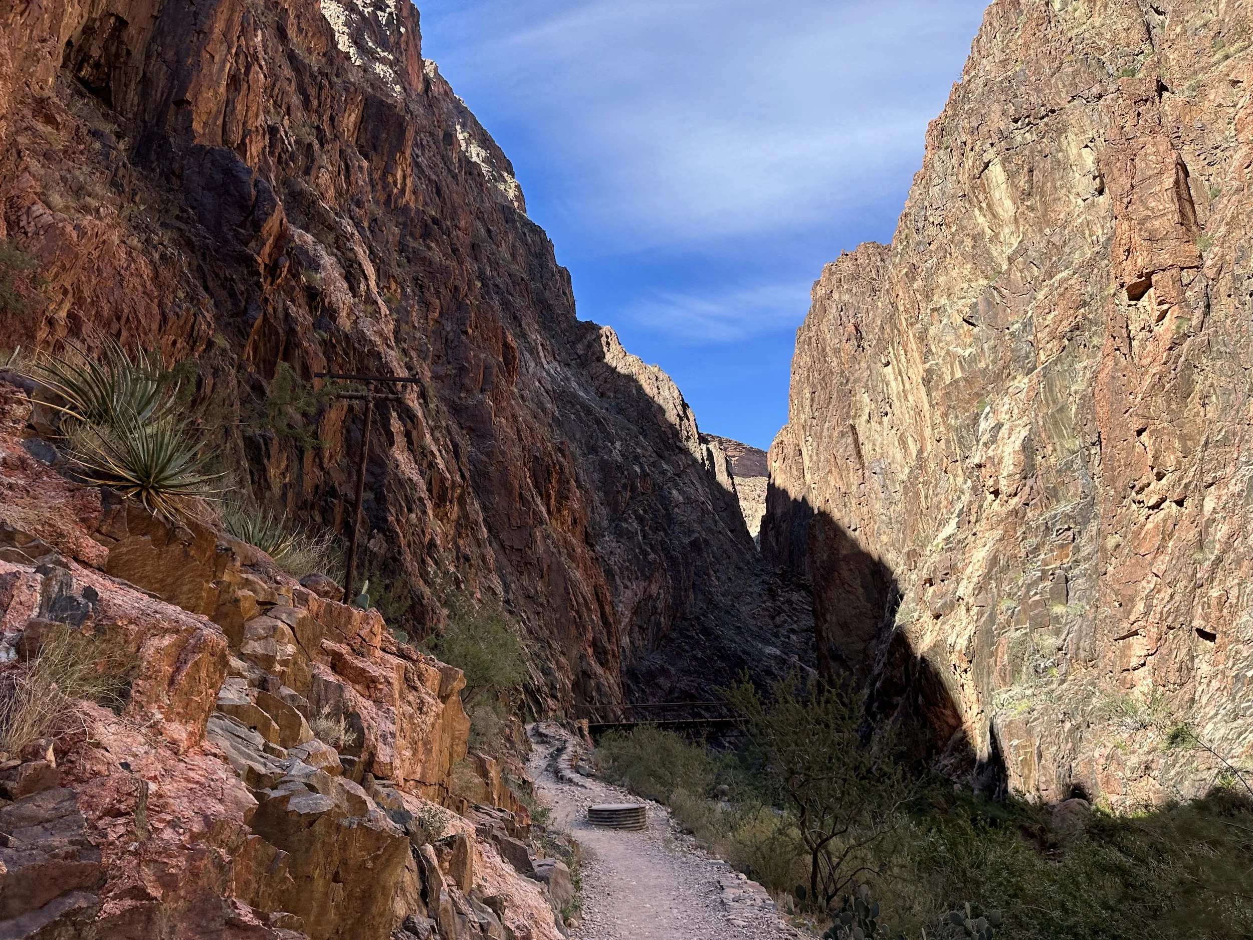
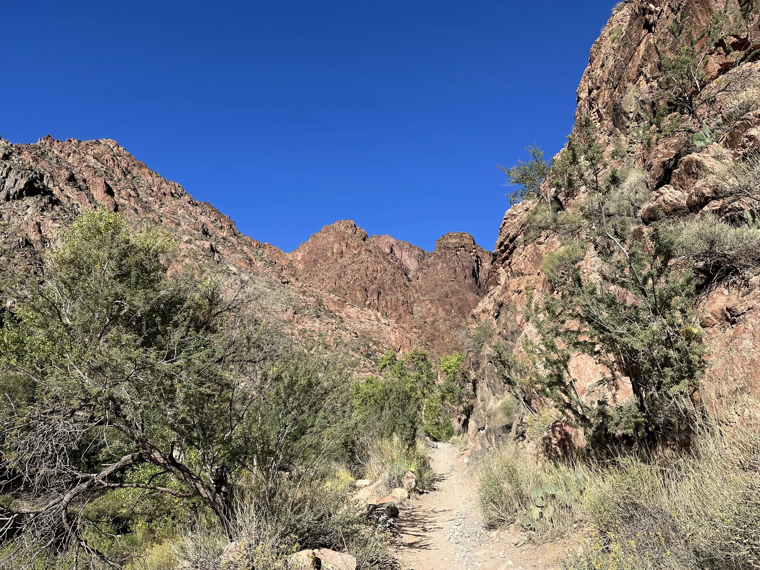
Beautiful hike northward through narrow canyon.
The next several miles of trail weaved gently through the high walls of a narrow canyon, hugging Bright Angel Creek. The trail was largely shaded and at every bend there was another phenomenal view down the canyon. It was my favorite section of the hike. Shawn, too, was grateful for any shaded sections because, no sunglasses.
The trail was far more well established and maintained than we’d expected, though I suppose with the number of people hiking and running the rim to rim, I should have guessed that.
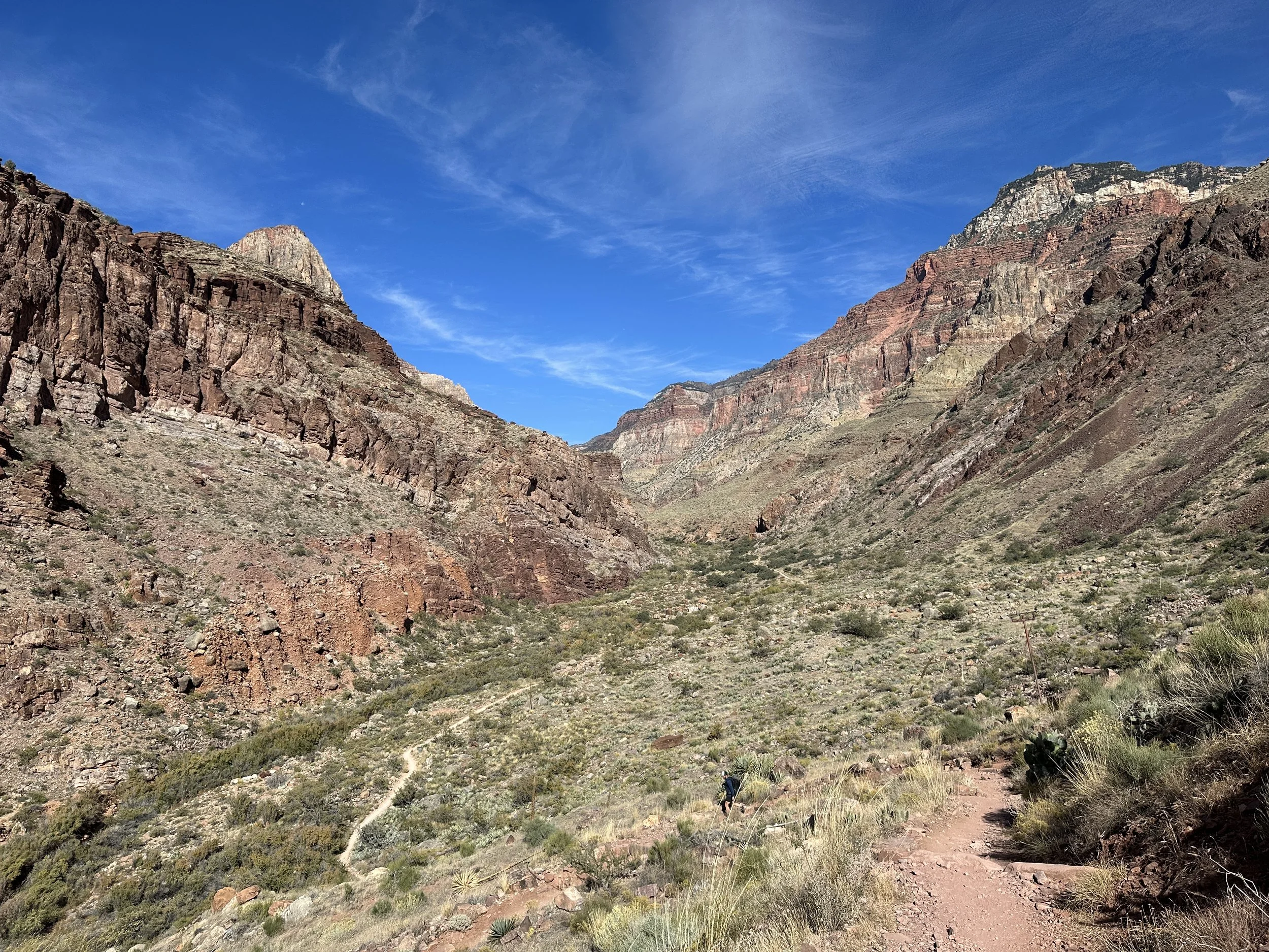
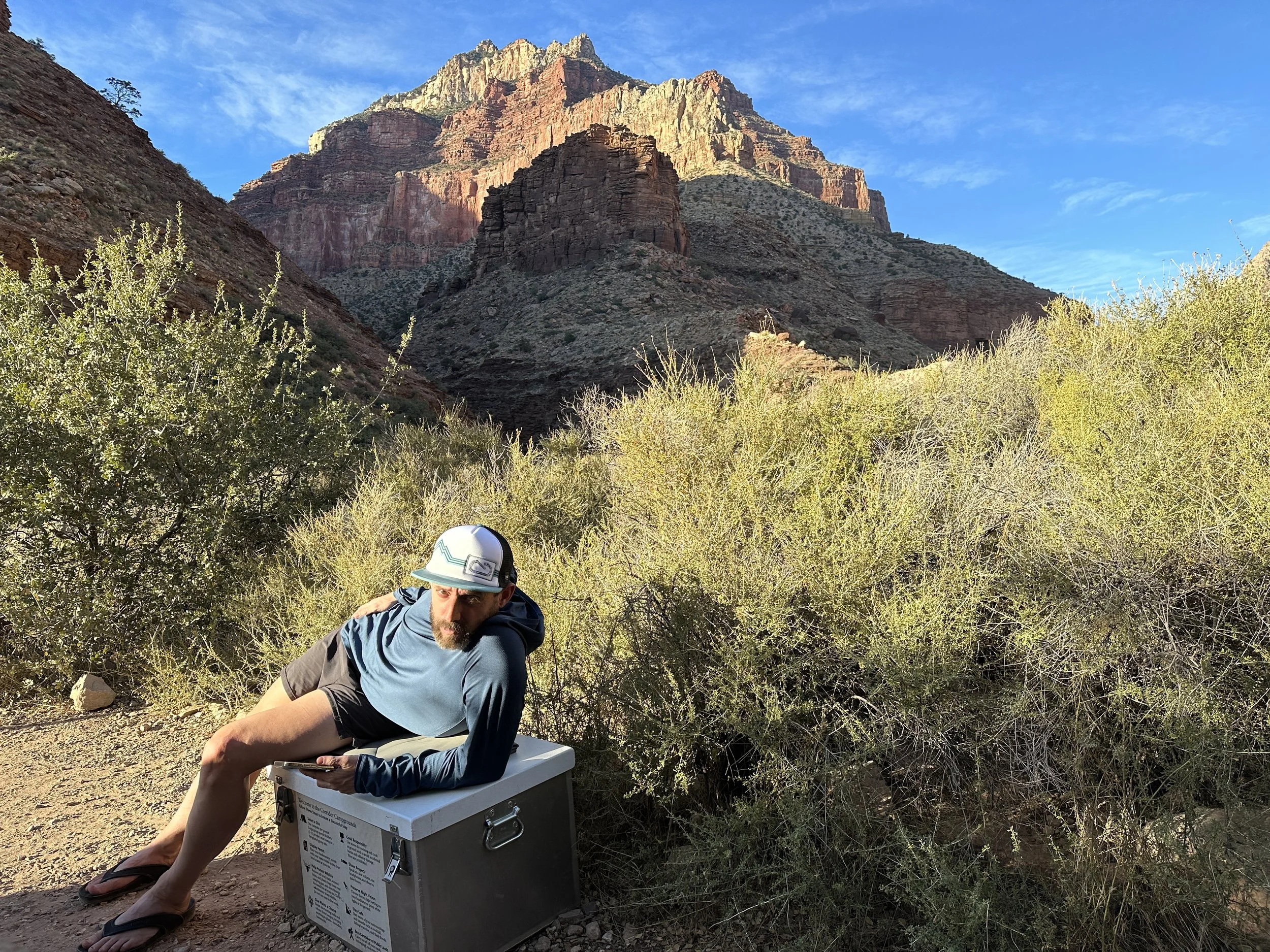
Hike northward along the North Kaibab Trail to Cottonwood Campground.
After several miles, the canyon opened up more, the river now running through a wide valley as the trail began to gently climb through the desert landscape.
As we neared the campground for the night, the trail hugged a canyon wall once again. The campground was dispersed through a corridor of trees, with each campsite tucked into small plots among manzanitas, cottonwoods, and other short scrubby trees.
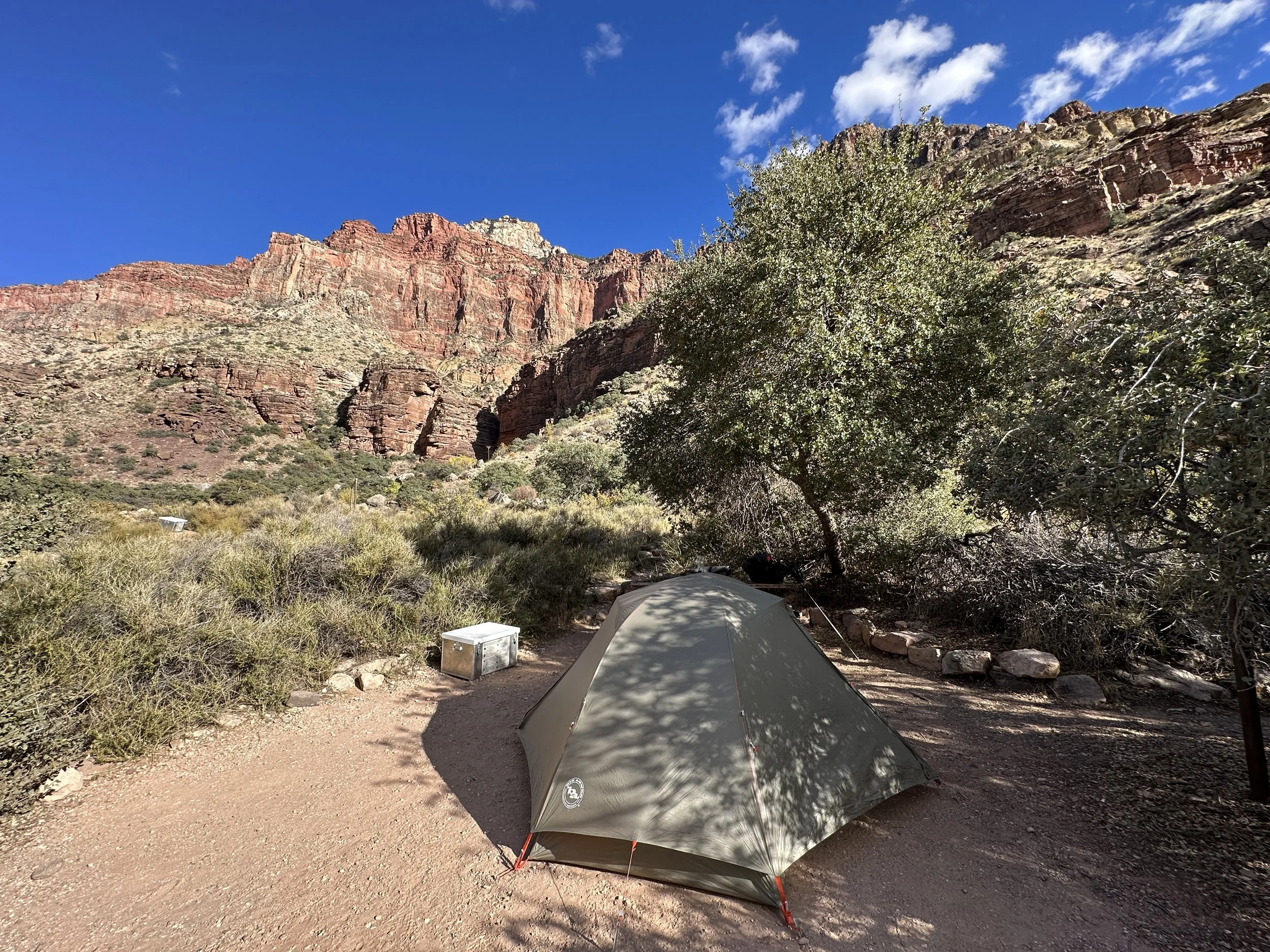
Home sweet home.
After a bit of poking around, we selected a site on the river side of the trail, placing our permit in the box to stake our claim. The site had a nice large flat space for our tent, plenty of small trees to provide a decent wind block, and a small trail that led to a nice little spot along the creek. Like the other sites, there was also a picnic table, a food storage box, and tall metal poles to hang our packs.
The campground itself also had pit toilets and a spicket with potable drinking water.
This was cushy backcountry camping. No digging cat holes? No filtering water? What would we do with all our spare time?
And, since we’d arrived a little before 2:30pm, we certainly had plenty of spare time. We had considered a side hike to Ribbon Falls on the way, but you could see the falls from the main trail and the flow was looking a bit lackluster. Not to mention, we didn’t really feel like the extra three miles, even despite our spare time.
And so, we set up our tent and sleep stuffs, organized ourselves a bit, and went down to the river to rinse our legs and soak our feet in the cold water. And it was cold.
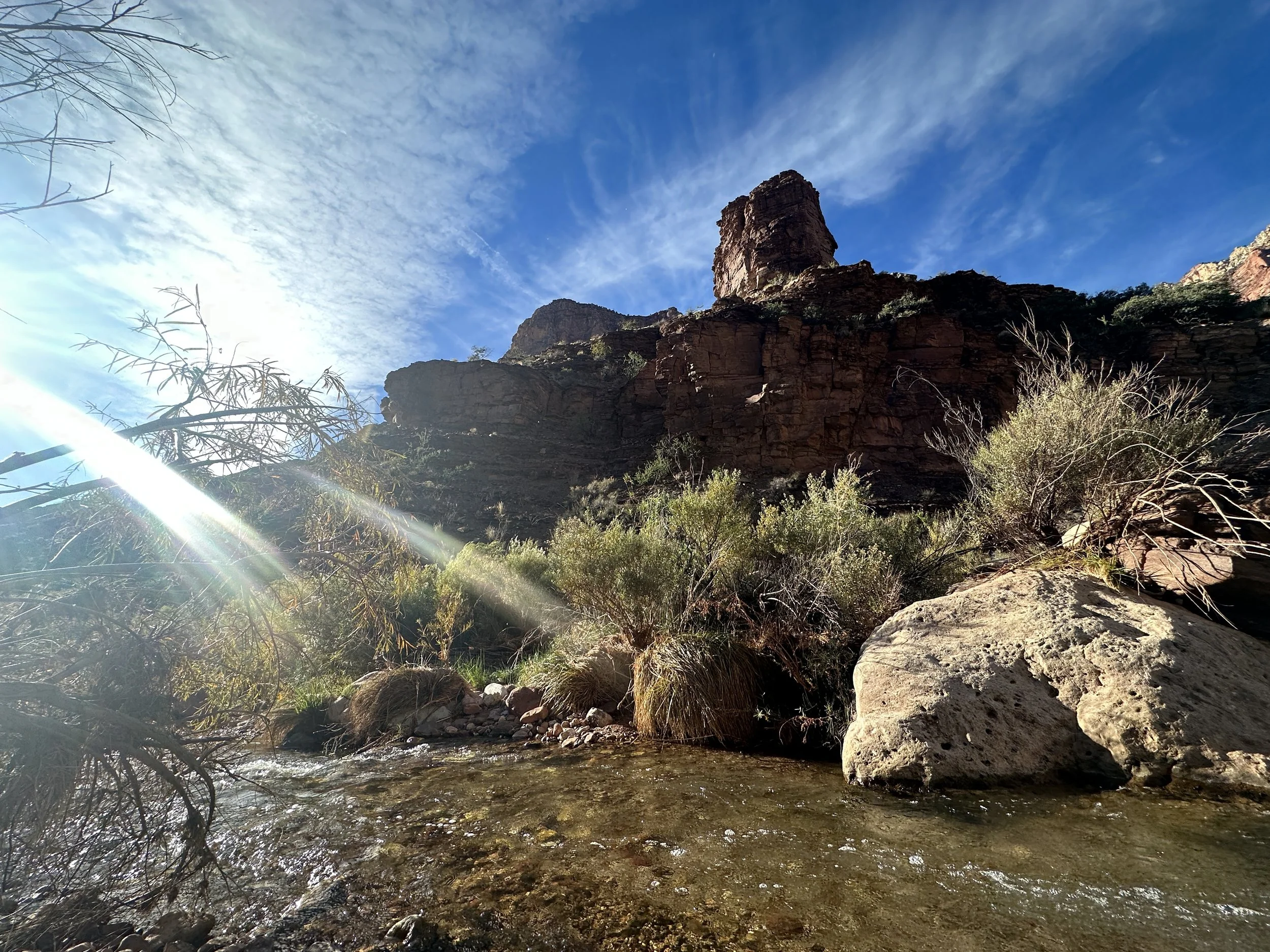
Our beautiful bit of Bright Angel Creek.
The small trail from our campsite brought us to the river’s edge right next to a small waterfall and a perfect flat rock for sitting and soaking feet. A great little spot. We rinsed our legs and soaked our feet for a bit before letting them dry in the sun.
Back at our campsite, we walked back down the trail to top off our water bottles before lazing around for a bit. Throughout the afternoon, more campers arrived, searching for open sites. We were very happy that we’d picked a site far up the trail from the large group site which we can hear some rumbles from even far away. Any closer and we’d be very upset. Like the crotchety old people we are becoming. Cut out that racket!
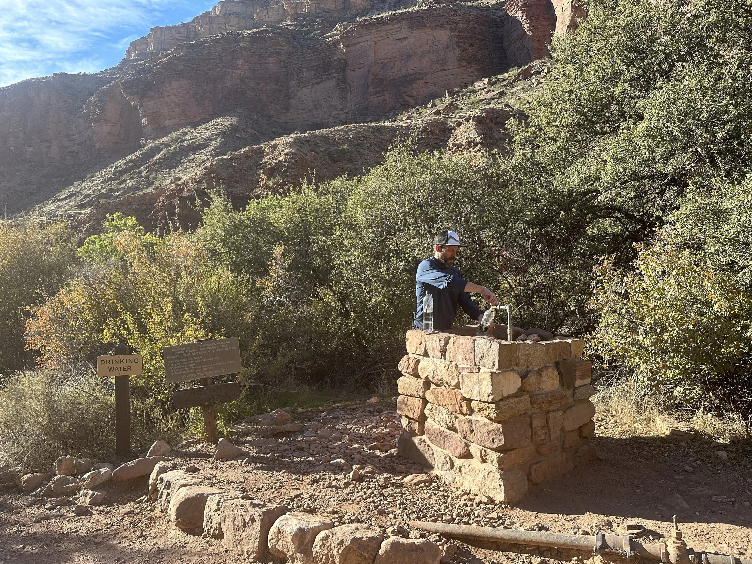
Taking care of the tough camp chores like collecting water from a potable water spicket.
At the waning late afternoon time of 4:30pm, we started making our dinners. Early bird special. Sunset was at 5:30pm, and we preferred to be tucked into our sleeping bags when it grew dark (and cold). Sunset = hiker midnight = sleepy time.
While Shawn had packed out a fancy backpacker meal, I made do with a more mundane pack of flavored mashed potatoes, topped with bacon bits for a bit of gourmet flair. I know, it’s hard to match my culinary genious.
A bit of hiker trash Vogue. Someone’s gotta look good out here.
Sunset brought flaming reds and yellows to the high canyon walls. Soon after we were tucked into our sleeping bags, the night dark by 6pm.