Day 14: Kagbeni to Marpha
Approximate Trekking Time: 3 ½ – 4 ½ hrs.
Distance: 15.9k / 9.9 miles
Overnight Elevation: 2670m/8760ft.
Like the route from Ranipauwa to Kagbeni, most of the trek to Jomsom is also along the road. There are some alternate routes to Jomsom, however not all can be joined from Kagbeni. For example the alternate route via Lubra/Lupra needs to be joined en route from Ranipauwa. In and around Jomsom there are several alternative trails you can choose en route to Syang or beyond to Marpha.
Following the small alleys southward through Kagbeni, the route to Jomsom eventually joined the low road along the mostly dried wide flat river bed of the Kali Gandaki before diverging onto a short section of dusty gravel trail that eventually rejoined the road.
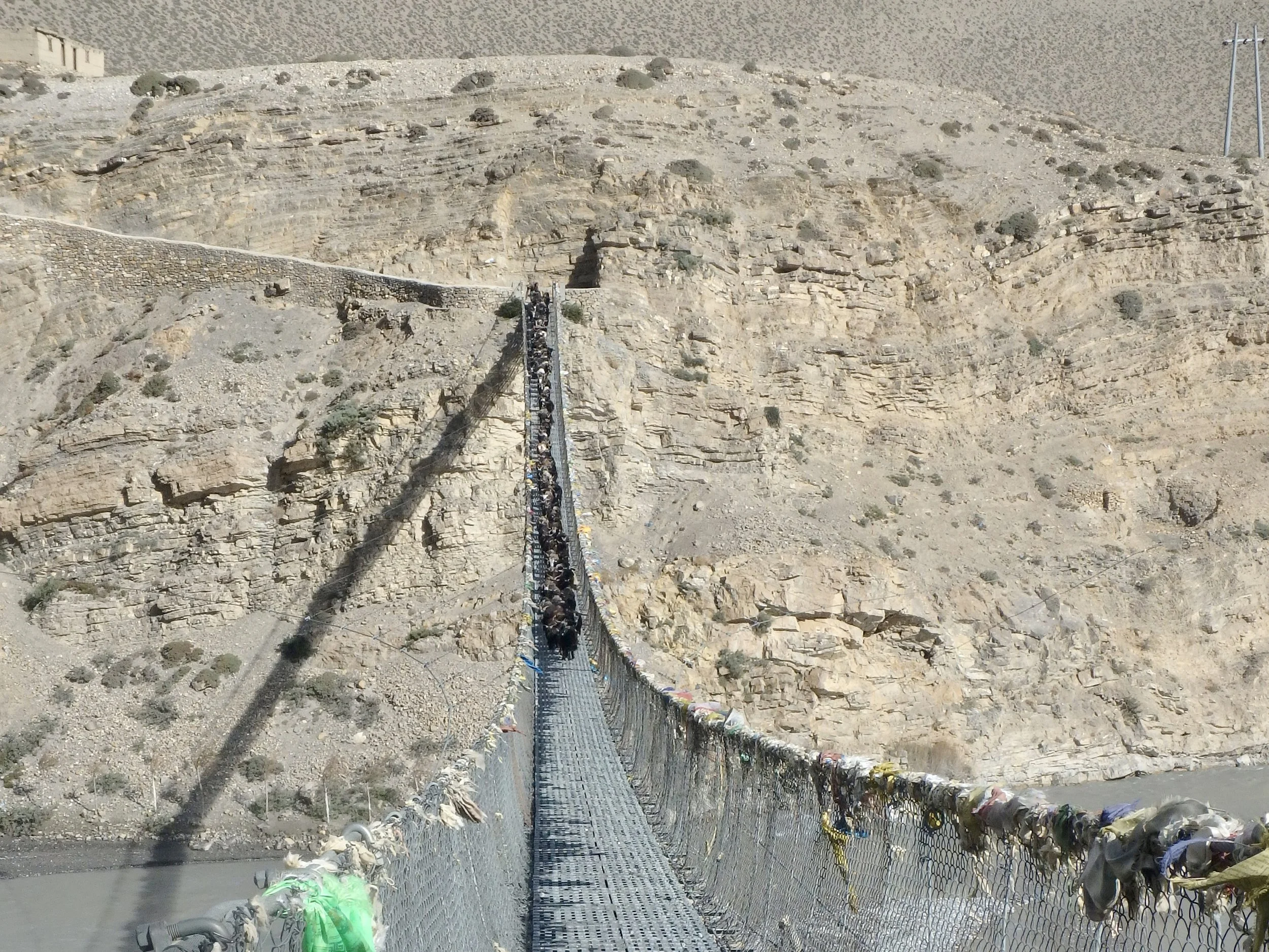
Not far beyond Eklai Bhatti, we witnessed an amazing sight as an entire flock of around 50 goats was herded over a suspension bridge. We, as well as several other trekkers and bikers, stopped to watch the spectacle as the herder yelled from the back, urging the timid goats forward. Along the circuit I had sometimes wondered if there were weight limits on the suspension bridge, and how many trekkers should be on them at once; watching the herd of goats on the bridge largely dispelled all further thought on this subject. The bridges were obviously constructed to hold some weight.
We continued winding our way along the road, some of which went through the river bed, until reaching Jomsom. Here we first passed through Old Jomsom. Just before a footbridge, an Annapurna Circuit trail marker directs travelers to continue south along the south/east bank of the river. We chose to continue over the footbridge and through (new) Jomsom to another alternative trail through Syang.
Many people opt to end their Annapurna Circuit trek in Jomsom, and bus, jeep, or fly back to Pokhara or Kathmandu from here, having heard that the back/western half of the circuit is no longer worth the hike due to increasing road construction. While there are several road sections on the western portion of the circuit, there are also many alternative trails and we found the western half of the circuit to be well worth the journey. There are many interesting and beautiful side trails and, with fewer travelers, we would often hike all day without seeing other trekkers but still have company in the lodges in the evenings – including other circuit trekkers as well as some heading northward for adventures in Mustang or other regions.
Toward the southern end of Jomsom, we followed a sign for the alternative trail toward Marpha. This route began by climbing high above Jomsom to a small yellow temple before continuing southwestward toward Syang. The dusty trail was lined by rocks leading us northward for a bit before descending into the Syang river valley via a series of steep switchbacks.
The wide riverbed was rocky, the black earth cracked like hardened lava in some areas and sooty like fine ash in others. The river itself was no more than a few feet wide and we hopped across the water on rocks en route to the western side of the riverbed, where we climbed back up out of the valley and into the village of Syang.
Syang was eerily quiet – deserted even. Upon entering, I saw one man carrying a load of wheat on his back disappear into a building, and not far down the road a small boy greeted us with a friendly “Namaste”. Other than these two, and a solitary cow chewing on a scrap of cardboard, we neither saw or heard another living soul in the village. The roads were quiet, the houses and buildings shut, and a wicker basket used for hauling loads on ones back rolled empty in the breeze of the small valley, like a tumble weed through a ghost town of the wild west. It’s possible that the upper portion of the village here is no longer used in favor of the lower portion along the road and river valley below. Or it’s possible that everyone saw us coming and simply hid in their homes until we had passed through.
At the south end of the village, we continued along a trail that followed the road from above. The dusty trail followed along the mountainside, some sections strewn with brittle crushed shale and other rock, and others sandy. Eventually the trail descended into the Pongkyu Khola river valley, rejoining the road. Here we crossed a small wooden bridge and veered right off the road toward Marpha (2670m/8760ft.).
One of the best qualities about Marpha is that the road runs outside of the town and not through it. Built up into the mountainside with small alleyways, the town is peaceful and quiet. Walking in from the road, you see the tiers of housing climbing the mountainside, chopped wood, hay, and grains drying atop each rooftop, where white prayer flags flapped in the breeze.
In the center of town, climbing into the sky, is the Samtenling Gompa, posted atop a long staircase of prayer wheels. Inside the complex, a small boy jumped with all his might to reach every last light switch to illuminate the main temple for us, the walls of which were painted brightly with scenes of the Buddha, Boddhitsavas, and other symbolic imagery.
Though we ate lunch at the Dhaulagiri Lodge, after annoyances with a number of things here, including the large number of flies in the common areas, we decided to stay at another lodge. We stayed at the Hotel Tanpopo, where we had an amazing en suite hot shower and bright clean room. This hotel also had a very nice glassed in patio in the back, overlooking the trees, flowers, and fields that fill the space between Marpha and the road.
